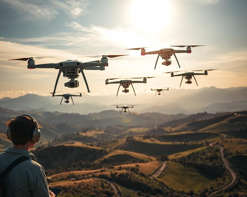
In recent years, the integration of drones in surveying has marked a significant turning point in the realm of surveying technology. Equipped with cutting-edge imaging systems and enhanced data collection capabilities, these unmanned aerial vehicles are revolutionising traditional methodologies, offering unparalleled precision and efficiency. The mapping improvements ushered in by drones enable professionals across various industries to gather intricate geographic data swiftly and accurately, fundamentally reshaping how we approach terrain analysis and resource management.
The Evolution of Surveying and Mapping Techniques
Surveying and mapping have undergone profound transformations over the centuries, reflecting advancements in methods and technology. From rudimentary instruments to sophisticated digital tools, these changes embody the journey of precision and efficiency in data acquisition.
Historical methods in contrast with modern practices
Traditional surveying techniques such as land surveying using chains, compasses, and manual calculations were once the norm. Surveyors relied on physical tools and painstaking measurements to create accurate maps of the landscape. These methods demanded an immense amount of skill and labour, often leading to delays in data collection and analysis.
In contrast, modern mapping practices leverage technologies such as satellite imagery and GPS, vastly improving both accuracy and speed. The introduction of drones has revolutionised the field, enabling surveyors to capture vast amounts of data quickly and efficiently, eliminating many of the errors associated with manual methods.
The rise of technological advancements
Technological advancements in surveying have reshaped our approach to land assessment. Innovations like remote sensing, 3D modelling, and digital mapping facilitate comprehensive data acquisition. These advancements significantly enhance precision, ensuring that the surveying process is not only faster but also more reliable.
The evolution from traditional techniques to modern practices illustrates not just a shift in technology but also a leap towards embracing innovative possibilities in surveying and mapping. As these technologies continue to develop, they promise to unlock even greater potentials in the understanding and management of our environments.
How are drones improving surveying and mapping?
Drones have revolutionised the approach to surveying and mapping, offering unmatched precision and efficiency. The integration of advanced technology enables improved data collection, ensuring that surveyors capture accurate information like never before. As a result, projects benefit from high-quality outputs while maintaining a rapid pace.
Enhancing data collection accuracy
With the advent of high-resolution imagery and sophisticated sensors, drone accuracy has reached impressive levels. These airborne devices minimise human error, allowing professionals to gather detailed data across vast terrains swiftly. By leveraging novel imaging technology, surveyors can perform detailed analyses that were previously complex and time-consuming, significantly enhancing the overall quality of data collected.
Speeding up the surveying process
The speed at which drones can operate dramatically enhances surveying speed, allowing for timely completion of projects. Traditional methods can be laborious, dragging out timelines; drones eliminate many of these delays. Their ability to cover large areas in a short amount of time not only expedites workflows but also facilitates real-time data capture. This rapid turnaround aids decision-making processes, significantly benefiting project lifecycles.
Benefits of Drones in Surveying and Mapping Applications
Drones have transformed the landscape of surveying and mapping, offering multiple advantages that enhance efficiency and accuracy. Their ability to optimise operational practices makes them invaluable in various applications.
Cost-effectiveness in project execution
One of the most significant benefits of drones lies in their cost-effective surveying capabilities. By utilising unmanned aerial systems, companies can drastically reduce manpower needs and operational costs. Drones speed up data acquisition, enabling projects to be completed in a fraction of the time it would take using traditional methods.
Accessing hard-to-reach areas
Drone accessibility is a game-changer when it comes to surveying challenging terrains. These aerial devices can easily navigate steep slopes, dense forests, or remote locations, areas that would normally pose a risk to human surveyors. This enhanced access not only ensures safety but also improves the comprehensiveness of the data collected.
Environmental impact considerations
The environmental benefits of drones enhance their appeal as a sustainable option for surveying practices. Using drones results in a lower carbon footprint compared to conventional techniques, as they require fewer resources and less energy. Choosing drones constitutes a responsible approach to addressing the environmental challenges faced by many industries today.
Key Technologies Behind Drone Surveying
Modern drone surveying relies heavily on advanced technologies that significantly enhance performance and accuracy. The integration of sophisticated drone navigation systems plays a crucial role in guiding drones during flights, ensuring they collect precise data in diverse environments. This reliability elevates the value of drone surveys across various sectors.
Navigation and control systems
Drone navigation systems combine GPS, inertial measurement units (IMUs), and advanced algorithms. These systems allow for autonomous flight paths while compensating for environmental factors such as wind or terrain changes. By ensuring reliable positioning and stability, drones can operate efficiently even in challenging conditions.
Advanced imaging technologies
The incorporation of imaging technology in drones has transformed data acquisition. Technologies like LiDAR and photogrammetry enable drones to capture high-resolution images and generate detailed 3D models of the surveyed area. These technologies facilitate accurate terrain analysis and improve the quality of mapping outcomes.
Integration with GIS
GIS integration is vital in processing and analysing the data collected by drones. This powerful combination allows users to incorporate aerial insights into comprehensive geographical datasets. As a result, stakeholders can make informed decisions based on accurate and well-structured information.
Applications Across Various Industries
Drones have transformed a variety of industries, showcasing their versatility and effectiveness in addressing unique challenges. From managing construction sites to optimising agricultural practices and advancing mining with drones, these applications reveal a new era of efficiency and precision.
Construction and infrastructure development
In the realm of construction, drone applications in construction are revolutionising project management. Drones facilitate comprehensive site surveys, allowing for precise tracking of progress and resource allocation. The use of aerial imagery enhances the understanding of site topography, enabling construction teams to make informed decisions quickly.
Agriculture and land assessment
Agriculture drone technology plays a pivotal role in modern farming. Drones equipped with high-resolution cameras collect vital data on crop health, water levels, and soil conditions. This information allows farmers to assess land more accurately, leading to better yields and sustainable land management practices. Aerial surveys help in detecting issues early, thus minimising losses.
In the mining sector, mining with drones proves essential for efficient resource management. Drones aid in site exploration, creating detailed 3D models to identify optimal extraction locations. Additionally, they monitor environmental compliance, ensuring that operations adhere to regulatory standards. This technological advantage reduces costs and enhances safety protocols in often hazardous environments.
Regulations and Challenges in Drone Use for Surveying
The regulatory landscape governing drone usage in the UK adds a complex layer to surveying and mapping. Operators must navigate various drone regulations UK to ensure their activities remain compliant with the guidelines established by the Civil Aviation Authority (CAA). Adhering to these regulations not only ensures safety but also fosters public trust in drone operations.
Compliance with aviation regulations
Compliance with aviation regulations is fundamental for drone operators. The CAA outlines specific rules concerning flight altitude, no-fly zones, and the requirements for obtaining necessary permits. Understanding these regulations is crucial for preventing legal issues and ensuring that drone surveying is conducted safely and responsibly.
Privacy concerns and data protection
As drones capture images and data, privacy issues come to the forefront. The potential for violating individual privacy rights necessitates vigilance in following data protection in drone surveying. Operators must be aware of laws protecting personal information, including obtaining consent before capturing images over private properties. Responsible drone use hinges on balancing the need for data collection with respect for individual privacy.
The Future of Drones in Surveying and Mapping
As we look ahead, the future of drone technology in surveying and mapping appears incredibly promising. Ongoing advancements in artificial intelligence are set to revolutionise how data is collected and analysed. The integration of AI can streamline data processing, allowing for quicker insights and enhanced decision-making capabilities. This is a pivotal step forward in surveying innovations, as it will enable professionals to harness the full potential of data gathered by drones.
Moreover, we can expect significant improvements in drone technology advancement, particularly regarding battery life and payload capacities. Longer flying times will permit drones to cover larger areas without requiring frequent recharges, making them even more efficient for extensive surveying projects. Additionally, increased payload capabilities will allow for the integration of more sophisticated sensors, further enhancing the quality and precision of data collected.
The pathway is clear: the potential for enhanced automated data processing opens exciting prospects for the future. As industries increasingly recognise the multifaceted benefits of drone usage, it is likely that these machines will become indispensable tools in a myriad of surveying applications. Embracing these innovations not only positions businesses for greater success but also fosters an environment where the accuracy and efficiency of surveying tasks are consistently elevated.